What is the latitude and longitude encoding of an ov2 file

Joined
Sep 15, 2022
Messages
4
Country
<img src="/styles/default/custom/flags/fr.png" alt="France" /> France
TomTom Model(s)
Go 5200 et Go 6200
Hi,
For the purpose of development, I am looking for the coding of an ov2 tomtom file since the latter persists in using this type of proprietary file for the PI files to import.

Apart from UTF-8 coding, it appears that latitudes and longitudes have a particular encryption unlike the wording of the POIs...

The developer site which still has SDKs still available will be closed on 05/31/2024 and the FAQs do not provide any information of this type in documentation.

Would you have this information?

1000 Thanks!

Best Regard,

Jean-Paul
 
From a post I wrote here - wow - back in 2009! An age ago.

Each entry in a simple custom OV2 file is as follows.

1 byte: type (always 2)
4 bytes: length of this record in bytes (including the T and L fields)
4 bytes: longitude coordinate of the POI
4 bytes: latitude coordinate of the POI
13 bytes: null−terminated ASCII string specifying the name of the POI

Coordinates are stored as 4−byte integers representing a WGS84 longitude or latitude, multiplied by 100,000 and rounded to the nearest integer. As such, an X−coordinate should always be a value between −18,000,000 and +18,000,000, and a Y−coordinate should be a value between −9,000,000 and +9,000,000
 
I didn't expect such a quick response to a technical question! Thank you very much for this information that you have dug up, all I have to do is code it in javascript language.

From memory the coding of OV2 had evolved since a number of old software no longer works correctly, apart from TTPoi_0_1_11_110.exe dating from 2008 downloaded a few years ago from your site…

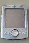
I am a dinosaur Tomtom user, in 2004 initially simple software usable on a Palm tablet like the Tungsten T2 by plugging in a GPS receiver above a SanDisk format memory card!

The time is no longer for free sharing of knowledge, where the content and structure of different file formats (NMEA, GPX etc.) were explained. This allowed authors such as my biker friend Roussillon to add functionalities... It's normal to want to shield programs to maintain control! Unfortunately the technical information is lost and the newbies from the after-sales service accessible to the brand's customers know how to use and explain the functionalities without knowing the engine.

The French forums owned by Tomtom or independent like GpsPassion or TomtomMax have disappeared… Forgive my Franglais, I am uncomfortable with written English. Unless I'm mistaken, you are the last forum of this prosperous period where sharing of knowledge, and points of interest remain relevant and above all where the questions are understood and the answers relevant.

Today, Tomtom updates imposed on the browser are done without explanation of the modifications or new features.
For example, with the current GO 5200 (free for life) I had to review the functionalities to discover in the Bluetooth menu a new addition "External Services" to uncheck to continue to benefit from the information traffic!

It is impossible to locate on the Tomtom site the functions carried over to the new models, for example presence or absence of a journey recorder...: the information no longer appears on the advertising brochures...

Tomtom MyDrive has been revamped but PI file imports still require an OV2 file whereas a more universal GPX format would be usable and very simple to put into service!

But does Tomtom always listen to its customers or forum feedback like yours?

Thank you, Hold on!

Kind regards to the whole team
 

Attachments

  • Palm-Tungsten-T2.jpg
    Palm-Tungsten-T2.jpg
    53.4 KB · Views: 6
@Cat75
Glad we could get you an answer quickly.

Yes, I remember Roussillon's site very well. He made some nice software contributions to the old Nav2 devices. We've lost a lot of functions over the years, and of course, apart from a few commercial devices that TT sold, it is impossible to load any 3rd party software now.

Like you, I've ripped and stripped every flavor of *.gpx file, pulled apart NMEA data, and dug into numerous TomTom file formats over the years. Back in 'the day', we were even able to improve some poor pronunciation of the devices by modifying the 'translation tables' for their text to speech engine. It sure was a lot more fun when there was an open architecture to play with.
 

Ask a Question

Want to reply to this thread or ask your own question?

You'll need to choose a username for the site, which only take a couple of moments. After that, you can post your question and our members will help you out.

Ask a Question

Members online

No members online now.

Latest resources

Forum statistics

Threads
29,264
Messages
198,042
Members
68,383
Latest member
Chrisso

Latest Threads

Back
Top